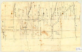
Original hand drawn map of "Follie Village, surveyed by me this 9th day of January 1850" by Donald Urquhart. Shows Colchester County land lots, owner names and directional measurements. Note: Map 2011.62.9 is very similar but has a few different names on the lots. Both maps were apparently done the same day by the same person. This map states, "This plan belongs to J. A. Fraser 2011.62.8
Original hand drawn map of A Plan of Lands in Folly Village, surveyed by Donald Urquhart, Dep. Sur., January 9, 1850.Shows Colchester County land lots, owner names and directional measurements. Note: Map 2011.62.8 is very similar but has a few different names on the lots. Both maps were apparently done the same day by the same person. 2011.62.9
Original hand drawn map showing Amet Sound, Tatamagouche Bay, Brule Harbour, John Bay, divided by county lines in red ink (Cumberland, Colchester and Pictou Counties). Also includes Main Roads to Tatamagouche and River John. 1999.94.48
Original hand drawn map showing Campbell's Estate as well as a lot of A. Patterson. Includes Church Burying Grounds, Blair's Stage Stables, Tatamagouche Harbour, French River and roads to New Annan, Durham & Wallace. No surveyor nor exact date recorded. 1999.94.20
Topographic map of East Folly Mountain area showing Wallace River, East Branch River, Pines Brook, Totten Brook, divided lots with owner names including Fleming, McLain, Slack, Forsyth, Patten, Crowell, Barnhill, Archibald, Duncan, McNutt and Faulkner. Drawn November 1868 by unknown person. 92.246.1
Original hand drawn map showing lands around the head of the West Branch of the French River at Tatamagouche. Surnames include Bell, Rev. William Patrick, Patterson and McKenzie. Surveyed by Charles Morris, Surveyor General, no date. 1999.94.11
Original hand drawn map attached to land grant of Abraham Patterson. Shows Tatamagouche River, water lots and owner names, including adjoining lots. 1999.94.1c
Original hand drawn map attached to Land Grant for Alexander Campbell showing Tatamagouche Harbour, French River, Waugh River and lots of Rev. Hugh Ross and K. MacDonald. 1999.94.1b
Original hand drawn map of lands belonging to the Estate of the Late Dr. William McCulloch, D.D., of Bible Hill, 1895. Includes Old Pictou Road, fence boundaries, neighboring properties, lands of Experimental Farm, buildings, and the north bank of the Salmon River. There is a red perimeter line drawn around the McCulloch estate. Drawn by W. H. Trumaine (?) E. E., Sept. 19, 1895. 2007.107.2
Original hand drawn map showing Plan to Colchester County Line including lots of grantees Patterson, Campbell, Graham, Rev. William and many others. DesBarres Grant area. 1999.94.30