Showing 78 results

Archival description
64 results with digital objects Show results with digital objects
Edith MacInnis collection
Collection · 1913-1973
Collection consists of materials accumulated by Edith MacInnis including Dr. MacDonald's Almanac, published by J. MacDonald, M.D., Binghamton, N.Y. (1913); T. Eaton Co. Maritimes Limited wallpaper sample book (ca. 1950s); EMAC Times, vol. 1, Grade 9-A school paper from St. Mary's Rural High (1973); The Canso Breeze, vol. 49, no. 29 (October 4, 1968); one minute book for the Melrose School Club (ca. 1952-1953); and one topographical map of Liscomb (1975). 2016.002
Enlarged Plan of Truro, 1838
Item · [1838]
Original hand drawn map shows early downtown Truro, "Sept. 9, 1838" appears in pencil as well as "44".Shows the first streets in Truro with placement of homes and homeowner names. Includes Salmon River, Bible Hill (center), Young's Road, Mill Race, Boyd's Brook, Parade Square, Gaol, Court House, and Churches. Several items seem to have been corrected: erased and moved in the same hand - perhaps this was a work in progress. Creator unknown. 2007.107.1
Florence Jessie Murray fonds
Fonds · [1884?] - 1975
Fonds consists primarily of Florence Jessie Murray's personal records regarding her career as a medical missionary in Korea, including correspondence, manuscripts, pamphlets and photographs. There is also a small volume of records that originated with her brother, Alexander Murray, and father, Robert Murray, including correspondence between Alexander Murray, Florence Jessie Murray and E.J.O. Fraser; Reverend Robert Murray's correspondence; and records regarding his involvement with the Navy, Army and Air Force Institutes. MS-2-535
Frank Fulton Collection
Collection · 1896 - 1973
The fonds consists of materials related to the history of Truro and Colchester County, NS that were collected by Frank Fulton throughout his lifetime, including directories, scrapbooks, books. The collection of 118 photographs show the Fulton family's activities during World War II, including images taken overseas. They also show the family spending time at Spencer's Point, NS; Big Cove Camp and Melmerby Beach, Pictou County, NS; businesses around Truro, NS during the 1970s; Frank's ironworks collection; and several postcards of scenes around Truro. 2012.6.1 - 46
Frank W. Jordan fonds
Fonds · 1885-2002, predominant 1930s-1970s
Fonds consists of personal, business, association and institutional records relating to the Municipality of the District of St. Mary’s, with a special emphasis on Sherbrooke, Nova Scotia. Included are meeting minutes, reports, and news from local associations including Heritage Goldenville Society, Royal Canadian Legion, Queen’s Lodge No. 34 A. F. & A. M., Sherbrooke Amateur Athletic Association, Sherbrooke Hockey League, St. Mary’s Boat Club, St. Mary’s Curling Club, St. Mary’s Driving Society, St. Mary’s Guest Home Society, St. Mary’s Historical Society, St. Mary’s District Rink Association and RecPlex, St. Mary’s River Association (1924-2003, predominantly 1970s-early 2000s); correspondence from the Department of Fisheries (c. 1920s); news clippings, reports, and press releases for local events including Communities in Bloom and Old Fashioned Christmas at Sherbrooke Village (1945-2002, predominantly early 2000s); maps, budgets, reports, meeting minutes, and other paperwork from Historic Sherbrooke Village (1971-1977); ledgers, news clippings, pulp samples from a local mill, and other papers related to local merchants and industry in the region (1872-2001, predominantly 1948-1968); papers from the Presbyterian, United, and St. James Anglican Churches, as well as the St. Mary’s Municipal School Board, Post Office, Library, St. Mary’s District Lions Club, St. Mary’s Memorial Hospital, Sunset Rest Cemetery, Down East Fire Fighters Association and Fire Department (1915-1996, predominantly 1930s-2000s); newspapers with Sherbrooke-related content, including the Family Herald and Weekly Star (1948), The Eastern Chronicle (1919), and Canso Breeze (1965-1966); a diary, family photographs, horse racing album, military service records, business ledgers, and personal family papers of Frank Jordan himself alongside unpublished memoirs and other papers from other Sherbrooke residents on the subject of local history; photographs, personal accounts, and newsletters about the St. Mary’s River (1900-2002, primarily concerning the 1956 flood). Also included in the collection are oral histories recorded at meetings of the St. Mary’s Historical Society (1978-1990). Fonds consists of the following series:Series 1: Andersons and Murdochs, Collected PapersSeries 2: Associations, LocalSeries 3: Department of FisheriesSeries 4: Diary (Digitized)Series 5: Emergency Measures OrganizationSeries 6: Events, LocalSeries 7: Historic Sherbrooke VillageSeries 8: Horse Racing Album (Digitized)Series 9: Business, LocalSeries 10: Institutions, LocalSeries 11: Municipality of the District of St. Mary’sSeries 12: Newspapers, RegionalSeries 13: Oral HistoriesSeries 14: Papers, CollectedSeries 15: Photographs (Digitized)Series 16: Periodicals, Collected RegionalSeries 17: St. Mary’s District Development AssociationSeries 18: St. Mary’s Historical Society and Historical MaterialSeries 19: St. Mary’s River 2020.011
Item · 1868
Topographic map of East Folly Mountain area showing Wallace River, East Branch River, Pines Brook, Totten Brook, divided lots with owner names including Fleming, McLain, Slack, Forsyth, Patten, Crowell, Barnhill, Archibald, Duncan, McNutt and Faulkner. Drawn November 1868 by unknown person. 92.246.1
James McKenzie Plan
Item · [1830]
Part of Frank Patterson Collection
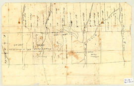
Original hand drawn map showing lands around the head of the West Branch of the French River at Tatamagouche. Surnames include Bell, Rev. William Patrick, Patterson and McKenzie. Surveyed by Charles Morris, Surveyor General, no date. 1999.94.11
Item · [after 1836]
Original hand drawn map which shows the topographical junction point of Colchester, Halifax and Guysborough Counties. This is an early, undated map, but since Guysborough was officially named in 1836, we know this map to be later than this date, but likely no later than 1875. The map shows land grants and grantee names, waterways and roads. Of note is Windsor College marked on 5 acres. 2019.24.1