Showing 209 results

Archival description
89 results with digital objects Show results with digital objects
Gordon Kinsman Collection
Collection · 1929 - 1939
The collection contains 3 cm of textual records related to the fur farming industry in Nova Scotia during the 1920s and 1930s. Many items are related to H. S. Cruikshank, a taxidermist of Colchester County. Photographs show early tanneries and the logging industry in Nova Scotia. 1997.26.1 - 57
Item · 1872
Original reproduction certificate issued to J. L. Peppard. Certifies that he "...is raised to Degree of Master Mason in the Lodge Cobequid No. 37. Given at Masonic Hall, Halifax this 10th day of February in the year of our Lord 1872 and of Light 5872." English text is displayed on the left hand side of the certificate - Latin translation is on the right. 2019.20.2
Item · 1868
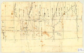
Topographic map of East Folly Mountain area showing Wallace River, East Branch River, Pines Brook, Totten Brook, divided lots with owner names including Fleming, McLain, Slack, Forsyth, Patten, Crowell, Barnhill, Archibald, Duncan, McNutt and Faulkner. Drawn November 1868 by unknown person. 92.246.1
James McKenzie Plan
Item · [1830]
Part of Frank Patterson Collection
Original hand drawn map showing lands around the head of the West Branch of the French River at Tatamagouche. Surnames include Bell, Rev. William Patrick, Patterson and McKenzie. Surveyed by Charles Morris, Surveyor General, no date. 1999.94.11
Item · [after 1836]
Original hand drawn map which shows the topographical junction point of Colchester, Halifax and Guysborough Counties. This is an early, undated map, but since Guysborough was officially named in 1836, we know this map to be later than this date, but likely no later than 1875. The map shows land grants and grantee names, waterways and roads. Of note is Windsor College marked on 5 acres. 2019.24.1