An original hand drawn map of the New Marsh, Lower Village (aka: Lower Truro, Colchester County, NS), showing numbered lots of land with owner names and acreage. Shows New Dyke Road, Soley's Creek, Cobequid Bay, Savage's Island and existing marsh area. Whole area = 51 ac, 2 qrs, 38 rods. Surveyed by Edmund Archibald, Land Surveyor, August 14, 1901. 2005.41.1
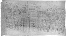
Original hand drawn map shows early downtown Truro, "Sept. 9, 1838" appears in pencil as well as "44".Shows the first streets in Truro with placement of homes and homeowner names. Includes Salmon River, Bible Hill (center), Young's Road, Mill Race, Boyd's Brook, Parade Square, Gaol, Court House, and Churches. Several items seem to have been corrected: erased and moved in the same hand - perhaps this was a work in progress. Creator unknown. 2007.107.1
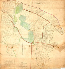
Original hand drawn map of lands belonging to the Estate of the Late Dr. William McCulloch, D.D., of Bible Hill, 1895. Includes Old Pictou Road, fence boundaries, neighboring properties, lands of Experimental Farm, buildings, and the north bank of the Salmon River. There is a red perimeter line drawn around the McCulloch estate. Drawn by W. H. Trumaine (?) E. E., Sept. 19, 1895. 2007.107.2
A collection of 5 maps which include: Approaches to St. John's Harbour (1921), The North Atlantic (1919), East Coast of North America (1880), Bay of Fundy, Southern Part (1934), and St. Martins, New Brunswick and NS (1934).These maps all belonged to Captain Jonathan Borden Marsh, who was from Economy, Colchester County. 2016.14.1 to 2016.14.5
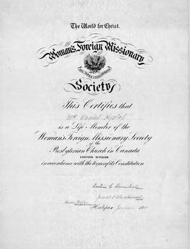
An original certificate which "certifies that Mrs. Daniel Hyslop (Hannah) is a Life Member of the Foreign Missionary Society of the Presbyterian Church of Canada, Eastern Division, in accordance with the terms of its Constitution. Halifax, June 1910. Signed by President and Treas. Sec.The Hislops (note spelling) lived in Onslow, NS. 2015.32.1
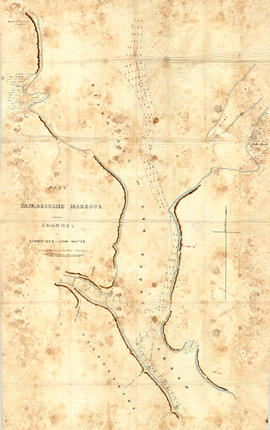
Original hand drawn map showing Tatmagouche (sic) Harbour, muddy flats dry at low tide, soundings at low water, Mingo's Wharf, Patterson's Wharf, Campbell's Saw Mill and Wharf, Bridge over the French River, New Government Wharf, Sand Point, Block House Point, Ingles Marsh. Ordinary rise of spring tides 6 feet 1 inch. No name of creator nor date. 2003.7.2
Original map showing Masstown Marsh including roads, waterways and granted lots with grantee names and acreages.Coloured: green indicates upland and islands, yellow indicates drains, creeks and ponds, brown indicates roads, red indicates dykes.Made by Thos. Miller, Surveyor, on July 25, 1863. Copy made for made for James Campbell by A. W. McLelan on September 12, 1863. 92.358.28
Londonderry Township map showing Planter Grantees and Lots. Traced from original by James Fulton, D. Surveyor, abt. 1780. Downscaled tracing done by Bruce McNutt, 1983. 2019.19.1
A plan of the settlement of River John and vicinity shows the area from Seafoam to Tatamagouche, including land grants and owner names as well as many details and waterways. 2017.32.1
Plan of field drains for property owned by Kenneth Crowe (B. 1893), in Central Onslow, Colchester County, NS. Prepared by the Nova Scotia Agricultural College and shows fences, drain location and dimensions, grades, tile and the main road. 2016.73.2