Showing 5157 results

Archival description
Item · 1866
Map of downtown Truro showing intersection of Prince and Outram Streets with proposed subdivision of Dr. John Waddell property lying between Prince Street and the Pictou Railway line. Includes lots with measurements and some businesses. Surveyed by Isaac N. Archibald, P. D. Surveyor, County of Colchester, March 29, 1866. 2019.9.1
Item · 1866
Part of Frank Patterson Collection
Original hand drawn map showing 20 acres described in words and plan for Alexander Matheson, Merchant in Colchester County, NS. Other surnames include Williamson, Pride, Carrie. Also shows Road to New Annan and Road to Truro. Surveyed by Robert L. Byers, Deputy Surveyor, New Annan, April 6, 1866. 1999.94.19
Item · 1867
Part of Frank Patterson Collection
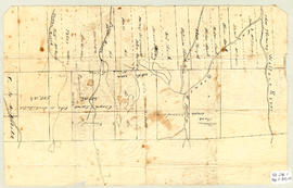
Original hand drawn map showing roads from Truro to Tatamagouche, both old and new. Also includes road to Farm Lake, Farm Lake, Whippy Lake, Black Lake, lots of surnames: Patterson, King, McKeen, Kennedy and others. 1999.94.41
Item · 1868
Topographic map of East Folly Mountain area showing Wallace River, East Branch River, Pines Brook, Totten Brook, divided lots with owner names including Fleming, McLain, Slack, Forsyth, Patten, Crowell, Barnhill, Archibald, Duncan, McNutt and Faulkner. Drawn November 1868 by unknown person. 92.246.1
Item · 1868
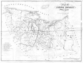
Map showing Pictou County mining areas including Nova Scotia Coal Co., Acadia Coal Co., Intercolonial Coal Mining Co., Halifax Company, Montreal & Pictou Co., East River Coal Co., Montreal & New Glasgow Coal Co., Pictou Mining Co., Vale Coal Iron & Mfg Co., and Mitchell & Barton's area. Undated, but research revealed Montreal & New Glasgow Colliery opened at Coal Brook and operated for one year only - 1868, therefore its inclusion on this map seems to date it closely to this time period. See novascotia.ca/archives/meninmines/timeline. Drawn by George Hattie, Land Surveyor. Printed by Barlan Desbarats Litho. Company, Montreal. 2019.5.1
Item · [1870]
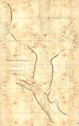
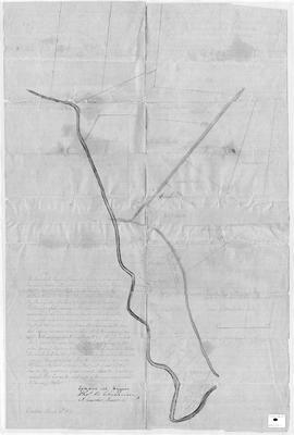
Original hand drawn map showing Tatmagouche (sic) Harbour, muddy flats dry at low tide, soundings at low water, Mingo's Wharf, Patterson's Wharf, Campbell's Saw Mill and Wharf, Bridge over the French River, New Government Wharf, Sand Point, Block House Point, Ingles Marsh. Ordinary rise of spring tides 6 feet 1 inch. No name of creator nor date. 2003.7.2
Item · 1871
Original hand drawn map which shows the property boundaries of land to be divided between 4 sons - James, William, Wilson and John Staples - heirs of William Staples Sr. of Onslow, NS., 1871.Edward Higgins, Thomas Chisholm and Alexander Barnhill state and witness that they were asked to divide the land between the 4 sons (presumably to settle an estate). 2011.81.1
Item · 1872
Original reproduction certificate issued to J. L. Peppard. Certifies that, "...he having expressed a desire to withdraw from the Lodge, is fully paid and has complied with the requirements, his leave is therefore granted." Signed at Truro, October 14, 1872. 2019.20.1