Showing 209 results

Archival description
89 results with digital objects Show results with digital objects
Item · 1956
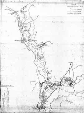
Copy of map drawn by H. Linneborn, Feb. 20, 1956. Map shows marsh locations along the Cobequid Bay & Minas Basin including roads, highways, trails, waterways, towns, railways and a legend. 2013.60.6A
Item · 1956
Copy of map drawn by H. Linneborn, Feb. 28, 1956. Map shows marsh locations along the Shubenacadie and Stewiacke Rivers in both Hants and Colchester County, NS. Includes roads, highways, trails, waterways, towns, railways and a legend. 2013.60.6B
Mattatall Lake
Item · 1967
Map showing Mattatal Lake and area including West Tatamagouche, Wallace Grant and Annandale in Colchester County, Nova Scotia, Canada. Shows roads, boundaries, game sanctuaries, crown land, large buildings, waterways, railways, lighthouse, telephone lines.11-E-11W. Complied by the Surveys and Mapping Division, Dept. of Lands and Forests from original map manuscripts by Dept. of Energy, Mines & Resources, Ottawa, Crown Land Survey data and aerial photographs taken 1967. 2003.59.25
Item · 1910
Original architectural drawing of the Brick Boiler House for the McLeod Pulp Co. Ltd., Liverpool, NS.Drawing No. 3, including cross sections and elevation diagram of the end of the building. July 1910. 2019.1.10
Item · 1910
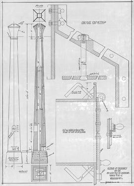
Original architectural drawing of the Details of Chimney for the McLeod Pulp Co. Ltd., Liverpool, NS.Drawing # 1, July 1910. 2019.1.11
Item · 1910
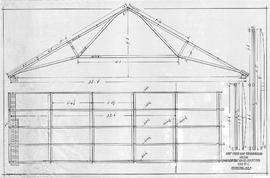
Original architectural drawing of the Roof Truss and Strong Backs for the McLeod Pulp Co. Ltd., Liverpool, NS.Drawing # 4, including cross section and dimensions. July 1910. 2019.1.12
Item · 1910
Architectural drawing of the Smoke Connections for the McLeod Pulp Co. Ltd., Liverpool, NS.Includes elevation, side views, plan of neck, measurements, diameters, and description of flue and smoke box requirements.July 1910. 2019.1.13