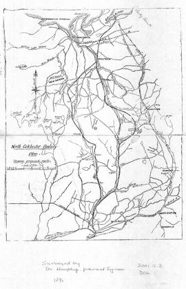
Map of North Colchester County, NS, showing proposed railway plan. Also includes existing Intercolonial Railway, Pictou Branch, Short Line through Tatamagouche, county towns, some waterways and roads. Surveyed by D. Murphy, Provincial Engineer, 1890. 2001.11.2
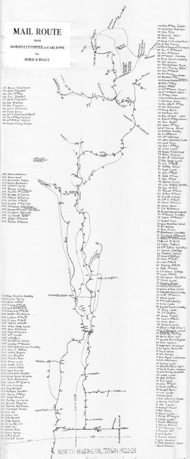
Hand drawn map showing the Mail Route from Marshall's Corner to Earltown, Colchester County in 1922-23.Includes roads and numbered dots along route which correspond to a list of home owners shown on the side of the map. Unknown creator and unknown exact date of creation. 2002.141.25
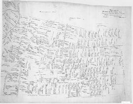
A map showing lots and property owners with boundaries of Onslow and Kemptown town lines, Pictou County line and includes Waugh’s River, French River, Tatamagouche East, Whippy Lake and Black Lake, south line of J.F.W. DesBarres Grant line. Roads include Old Road Onslow to Tatamagouche, West Branch Rd., Corktown Road, Truro Road, North River Road. 2002.146.1
1 original hand drawn map showing new proposed road as continuation of Gunn's Road, connecting from West Branch Road to River John Road and the properties it will cross (McKay, Munroe, McBain and Langille's). Surveyed by Gilbert Sutherland Feb. 11, 1884.Confirmed - May Session, 1884. Recorded in Road Bank pgs 476-9. 2019.45.1