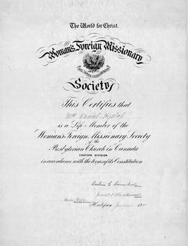
An original certificate which "certifies that Mrs. Daniel Hyslop (Hannah) is a Life Member of the Foreign Missionary Society of the Presbyterian Church of Canada, Eastern Division, in accordance with the terms of its Constitution. Halifax, June 1910. Signed by President and Treas. Sec.The Hislops (note spelling) lived in Onslow, NS. 2015.32.1
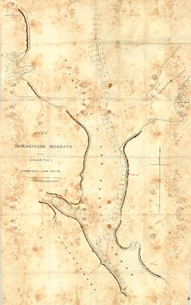
Original hand drawn map showing Tatmagouche (sic) Harbour, muddy flats dry at low tide, soundings at low water, Mingo's Wharf, Patterson's Wharf, Campbell's Saw Mill and Wharf, Bridge over the French River, New Government Wharf, Sand Point, Block House Point, Ingles Marsh. Ordinary rise of spring tides 6 feet 1 inch. No name of creator nor date. 2003.7.2
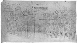
Original hand drawn map of downtown Truro, 1900, labelled with red dots to indicate present location of arc street lights - 48 in all. Red circles indicate I.C.R. (Intercolonial Railway) lights. Shows Salmon River and part of the railway through Truro. 2019.7.1
A plan of the settlement of River John and vicinity shows the area from Seafoam to Tatamagouche, including land grants and owner names as well as many details and waterways. 2017.32.1
1 original hand drawn map showing new proposed road as continuation of Gunn's Road, connecting from West Branch Road to River John Road and the properties it will cross (McKay, Munroe, McBain and Langille's). Surveyed by Gilbert Sutherland Feb. 11, 1884.Confirmed - May Session, 1884. Recorded in Road Bank pgs 476-9. 2019.45.1
An original hand drawn map of the New Marsh, Lower Village (aka: Lower Truro, Colchester County, NS), showing numbered lots of land with owner names and acreage. Shows New Dyke Road, Soley's Creek, Cobequid Bay, Savage's Island and existing marsh area. Whole area = 51 ac, 2 qrs, 38 rods. Surveyed by Edmund Archibald, Land Surveyor, August 14, 1901. 2005.41.1
Original hand drawn map which shows the property boundaries of land to be divided between 4 sons - James, William, Wilson and John Staples - heirs of William Staples Sr. of Onslow, NS., 1871.Edward Higgins, Thomas Chisholm and Alexander Barnhill state and witness that they were asked to divide the land between the 4 sons (presumably to settle an estate). 2011.81.1
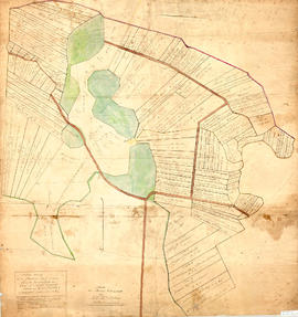
Original map showing Masstown Marsh including roads, waterways and granted lots with grantee names and acreages.Coloured: green indicates upland and islands, yellow indicates drains, creeks and ponds, brown indicates roads, red indicates dykes.Made by Thos. Miller, Surveyor, on July 25, 1863. Copy made for made for James Campbell by A. W. McLelan on September 12, 1863. 92.358.28