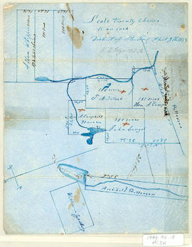
Showing 66 results

Archival description
42 results with digital objects Show results with digital objects
Item · 1857
Part of Frank Patterson Collection
Original hand drawn map showing plan of lots in the District of Sterling, Colchester County, NS. Surnames include Patterson, Campbell, McIntosh, Langel, Whippie and Geddes. Surveyed by Robert L. Byers, April 9, 1857. 1999.94.18
Item · 1864
Part of Frank Patterson Collection
Original hand drawn sketch plan showing the road by New Annan, the road by the Willow Church and the new line of road from Tatamagouche to Robert Cock's. Surveyed by Robert L. Byers, March 19, 1864. 1999.94.9
Item · 1866
Part of Frank Patterson Collection
Original hand drawn map showing 20 acres described in words and plan for Alexander Matheson, Merchant in Colchester County, NS. Other surnames include Williamson, Pride, Carrie. Also shows Road to New Annan and Road to Truro. Surveyed by Robert L. Byers, Deputy Surveyor, New Annan, April 6, 1866. 1999.94.19
Item · 1867
Part of Frank Patterson Collection
Original hand drawn map showing roads from Truro to Tatamagouche, both old and new. Also includes road to Farm Lake, Farm Lake, Whippy Lake, Black Lake, lots of surnames: Patterson, King, McKeen, Kennedy and others. 1999.94.41
Item · 1853 - 1867
Original hand drawn map showing Tatamagouche and Area - DesBarres Grant lots and others. Showing county lines, lots, owners, waterways. Dates 1853 - 1867. Surveyed by George Hattie, Land Surveyor 2003.7.1
Rev. Robert Blackwood fonds
Fonds · 1817-1870
Fonds consists of sermons written by Rev. Robert Blackwood. Each sermon includes the date and location of where it was given. Fonds also includes several written speeches, personal notes and reminiscences, and notes regarding payment for his services. MG 1, Vol. 20.