Showing 391 results

Archival description
184 results with digital objects Show results with digital objects
Item · 1856
Part of Frank Patterson Collection
Original hand drawn map showing lands next to William Campbell in Colchester County, NS. Other lot owners include Byers, Hays, Cutten, Sutherland, Henderson, Matatall, Church Lot, Simpson, School House Lot, Morrison and McBurnie along the main road through Tatamagouche, NS. Surveyor name cut off and no date shown. 1999.94.21
Item · 1857
Part of Frank Patterson Collection
Original hand drawn map showing main road by shipyard of lots inlcuding William McCully and others. Includes letter to William Campbell Esq. from Robert Byers, Tatamagouche area. 1999.94.28
Item · 1857
Part of Frank Patterson Collection
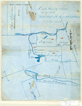
Original hand drawn map showing plan of lots in the District of Sterling, Colchester County, NS. Surnames include Patterson, Campbell, McIntosh, Langel, Whippie and Geddes. Surveyed by Robert L. Byers, April 9, 1857. 1999.94.18
Item · 1858
Original hand drawn map of the Back Lots of the Township of Truro, NS. Copied by Isreal Longworth March 7, 1858. Includes land grants and names of property owners, some roads, marshlands and waterways. 2019.38.1
Item · 1861
An original hand drawn map which states, "I certify that this plan is a true and correct copy of a Plan of the Partitions of the Township of Londonderry filed in this office. Dept. of Crown Lands, 12 Feby 1861, Samuel P. Fairbanks, Comm. Crown Lands.Includes granted lands, names of lot owners and acreage. 2011.62.10