A plan of the settlement of River John and vicinity shows the area from Seafoam to Tatamagouche, including land grants and owner names as well as many details and waterways. 2017.32.1
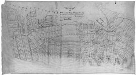
Original hand drawn map showing Tatamagouche and Area - DesBarres Grant lots and others. Showing county lines, lots, owners, waterways. Dates 1853 - 1867. Surveyed by George Hattie, Land Surveyor 2003.7.1
Fonds consists of sermons written by Rev. Robert Blackwood. Each sermon includes the date and location of where it was given. Fonds also includes several written speeches, personal notes and reminiscences, and notes regarding payment for his services. MG 1, Vol. 20.
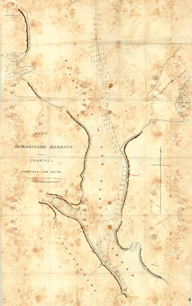
Original hand drawn map showing Tatmagouche (sic) Harbour, muddy flats dry at low tide, soundings at low water, Mingo's Wharf, Patterson's Wharf, Campbell's Saw Mill and Wharf, Bridge over the French River, New Government Wharf, Sand Point, Block House Point, Ingles Marsh. Ordinary rise of spring tides 6 feet 1 inch. No name of creator nor date. 2003.7.2
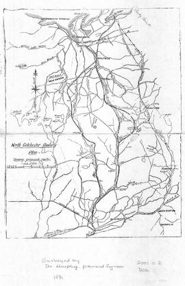
Map of North Colchester County, NS, showing proposed railway plan. Also includes existing Intercolonial Railway, Pictou Branch, Short Line through Tatamagouche, county towns, some waterways and roads. Surveyed by D. Murphy, Provincial Engineer, 1890. 2001.11.2
Fonds consists of three hotel registers, which recorded the guests' name and residence. Occasionally merchants or entertainers would sign their name and some information about their product or show as a form of advertisement in the register. Pages have been torn out of the 1903 register.