Showing 15 results

Archival description
13 results with digital objects Show results with digital objects
Collection · 1749-2005
The Eastern Shore Archives has collected a variety of cartographic materials produced by a number of different cartographers, government departments, and businesses. These materials were accumulated over time by the archives from various sources as opposed to being generated by a single creator. Collection consists primarily of maps of Nova Scotia and various areas along Nova Scotia’s Eastern shore. They vary from nautical maps to topographical maps, to land grant and Crown Land maps, to geological surveys. Some include illustrations, descriptions, and directories. Accession numbers: 2003.026, 2003.087, 2005.023, 2012.005, 2013.042, 2013.043, 2013.044
Item · ca. 1960- 1980
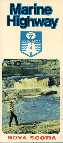
This item is a brochure produced by the Eastern Shore Tourist Association, featuring information on the Route 7 Marine Highway, a scenic route that forms part of the Trunk 7 highway and stretches from Dartmouth to Canso, skirting the Atlantic coastline through seaside villages and farming communities, past beaches, museums and other points of interest. The item consists of a map and a brief description of the Eastern Shore including local and natural attractions, communities, and history. The brochure also includes several images of scenery and attractions that can be found along the way. Accession number: 2013.018
Item · 1938
This history is a discrete item and was written by Clare Palmer in 1938 when she was about thirteen years old. It was likely part of a school assignment as there appears to be a comment written by the teacher on the last page. In his or her comment the teacher praises the value of the information provided by Clare and suggests that she donate it to the public archives. This handwritten, handmade history book is based on information provided by Mr. George Marks, Mrs. Bruce Marks, and Mr. and Mrs. E. A. Marks, whose contribution is acknowledged by Clare at the outset of her work. Her history includes chapters on the first settlers, the growth of the settlement, Ship Harbour industries, schools, transportation, churches, food, clothing, and lights; amusements, public buildings, prominent people, nature, and a final chapter that discusses Nichol Island and Wolfe Point as well as the origin of the name “Ship Harbour.” The book includes three hand drawn maps: one of Ship Harbour that features dwellings, G. L Monk’s store and mill, the J. L. factory, and the chapel; a second map depicting early roads in the area in 1863 as well as a ferry; and one small map of Nichol Island. The second last page also includes a photograph of the lighthouse at Wolfe Point on Nichol Island, which is were Clare lived with her family in the lightkeeper’s house. The book also includes two newspaper clippings, one about Daniel Weeks and one about the 50th anniversary of Mr. and Mrs. Edward Addington Marks which includes a picture. Accession number: 2013.013
Fonds · [ca. 1900]-2008, predominant 1974-2004
Fonds consists of records of the Chezzetcook Historical Society and its members. Textual records were created between about 1900- 1930, 1950- 1955, 1965, and 1974- 2008, but the majority date to between 1974 and 2004. Fonds includes research material, genealogical information, publications, society records regarding its operation, inventories, maps, and photographs. Accession number 2009.018.
Robert Kim Stevens fonds
Fonds · [ca. 1972]-[ca. 2002]
Fonds consists of records of the activities of Robert Kim Stevens. Records were created and accumulated between about 1972 and 2003. Fonds is arranged into five series: correspondence, research material and publications, family files,maps, and drawings. Accession number 2003.010.
Fonds · [ca. 1784-1998]
Fonds consists primarily of documents related to Katherine L. Stoddard’s research and her interest in genealogy, particularly that of her own family. Stoddard’s records include information related to many Eastern Shore families, including the Stoddard and Ritcey families, as well as local history. Fonds also includes correspondence, cookbooks and handwritten recipes, photographs, postcards, maps, certificates, land grants, yearbooks, deeds, and wills. Accession number: 2013.008
Collection · 1931-1945
Collection consists of forty monochrome aerial photographs of the Eastern Shore taken between 1931 and 1945. Also includes seven corresponding flight maps. Photographs illustrate the landscapes and coastlines of various locations along the Eastern Shore as they were in 1931-1945. Areas covered by the aerial photographs within this collection include Owl's Head, Little Harbour, Clam Harbour, Burnt Point, Clam Bay, Lake Charlotte, Ship Harbour, Upper Lakeville, Oyster Pond, and the Jeddores. Accession number 2013.039
Fonds · 1969-1995, predominant 1972-1983
Fonds consists of records of the Association for Preservation of the Eastern Shore and its members. Records were created between 1969 and 1995, but predominantly between 1972 and 1983. Records in the fonds are arranged into the following series: S1- Ship Harbour National Park proposal S2- Community activism S3- Research material S4- Correspondence S5- Meeting minutes S6- Memorandums of association S7- Financial records S8- Photographs S9- Newspaper clippings Accession numbers 2009.035, 2009.036, 2013.019
E.J. Webber fonds
Fonds · 1941-1945, 1951-1955
Fonds consists of records related to the activities of E. J. Webber during his time spent serving with the 2nd Reserve Battalion Halifax Rifles in World War II and his shared activities with his wife Babe Webber in her role as postmistress in Lake Charlotte during the 1950s. Records were created between 1941 and 1945, and between 1951 and 1955. Fonds has been arranged into the following two series: S1- 2nd Reserve Battalion Halifax Rifles S2- Lake Charlotte Post Mistress Accession number 2009.045