Série organique
·
19-?
Fait partie de Fonds Père Clarence d'Entremont
98 résultats avec objets numériques
Afficher les résultats avec des objets numériques

Pièce
Fait partie de Fonds Père Clarence d'Entremont

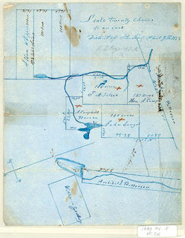
Pièce
·
[1830]
Fait partie de Frank Patterson Collection

Pièce
·
[1850]
Fait partie de Frank Patterson Collection

Pièce
·
[1850]
Fait partie de Frank Patterson Collection

Pièce
·
[1850]
Fait partie de Frank Patterson Collection

Pièce
·
[1850]
Fait partie de Frank Patterson Collection

Pièce
·
[1850]
Fait partie de Frank Patterson Collection

Pièce
·
[1850]
Fait partie de Frank Patterson Collection
Pièce
·
1857
Fait partie de Frank Patterson Collection