Showing 162 results

Archival description
98 results with digital objects Show results with digital objects
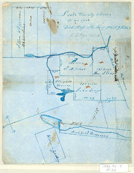
S - Cartes Géophraphiques
Series · 19-?
Part of Fonds Père Clarence d'Entremont
Cette série est constituée de 192 cartes géographiques, incluant des cartes anciennes, moderne, routières, topographiques et bénéficaires. Ces cartes géographiques illustrent la vie et les parcours des Acadiens à travers le monde 1998.3-f11
Havre de Pubnico
Photographie d'une carte gra[joqie des terres entourant le havre de Pubnico montrant la réparation des terres entre les différents propriétaires. La date, le titre, l'échelle et la provenance du document no sont pas indiqués. 1998.3-f11
James McKenzie Plan
Item · [1830]
Part of Frank Patterson Collection
Original hand drawn map showing lands around the head of the West Branch of the French River at Tatamagouche. Surnames include Bell, Rev. William Patrick, Patterson and McKenzie. Surveyed by Charles Morris, Surveyor General, no date. 1999.94.11
Plan of DesBarres Grant
Item · [1850]
Part of Frank Patterson Collection
Original hand drawn map of a plan of the DesBarres Grant along the French River. Surnames include Patterson, Austin, Langille. Shows the road from Tatamagouche to New Annan, Colchester County, NS. No surveyor recorded, nor date. 1999.94.12
Plan of DesBarres Grant
Item · [1850]
Part of Frank Patterson Collection
Original hand drawn map which appears to be very similar to map 1999.94.12. It displays the same area of the DesBarres Grant, but no surnames are provided on this map. No Surveyor nor date...perhaps a working map which is incomplete. 1999.94.13
Item · [1850]
Part of Frank Patterson Collection
Original hand drawn map showing a rough plan of lands back of George Millar's. Property owner names include Langille, Campbell, Byers, Kent, Primrose. Shows Byer's Lake and Johnston Lake. Part of DesBarres Grant in Tatamagouche area, Colchester County, NS. 1999.94.14
Plan of John Bonyman's Farm
Item · [1850]
Part of Frank Patterson Collection
Original hand drawn map showing John Bonyman's farm, French Intervale farms, Robert and George Cooper's property as well as land owned by Patriquin and Wilson. This area is part of the DesBarres Grant, Colchester County, NS. No Surveyor, nor exact date. 1999.94.15
Item · [1850]
Part of Frank Patterson Collection
Original hand drawn map showing lot of George Clark and others including: Fraser, Mingo, Murphy, and Harris. Appears to be along an unidentified "street" ...most likely in Tatamagouche, Colchester County, NS. No surveyor nor date given. 1999.94.16
Item · [1850]
Part of Frank Patterson Collection
Original hand drawn map showing the main road through Tatamagouche, Colchester County, NS, including the water lots and land owners: Patterson, Campbell, Purves, McCurdy, Patriquin, Williamson,and Bryelon. Also shows Road to New Annan. No surveyor nor date given. 1999.94.17
Item · 1857
Part of Frank Patterson Collection
Original hand drawn map showing plan of lots in the District of Sterling, Colchester County, NS. Surnames include Patterson, Campbell, McIntosh, Langel, Whippie and Geddes. Surveyed by Robert L. Byers, April 9, 1857. 1999.94.18